
Alamo, CA
- Elevation
- 270 ft
- General Quality Overall rating out of 100
Highlights
What stands out in Alamo
Explore
More places like Alamo
About Alamo
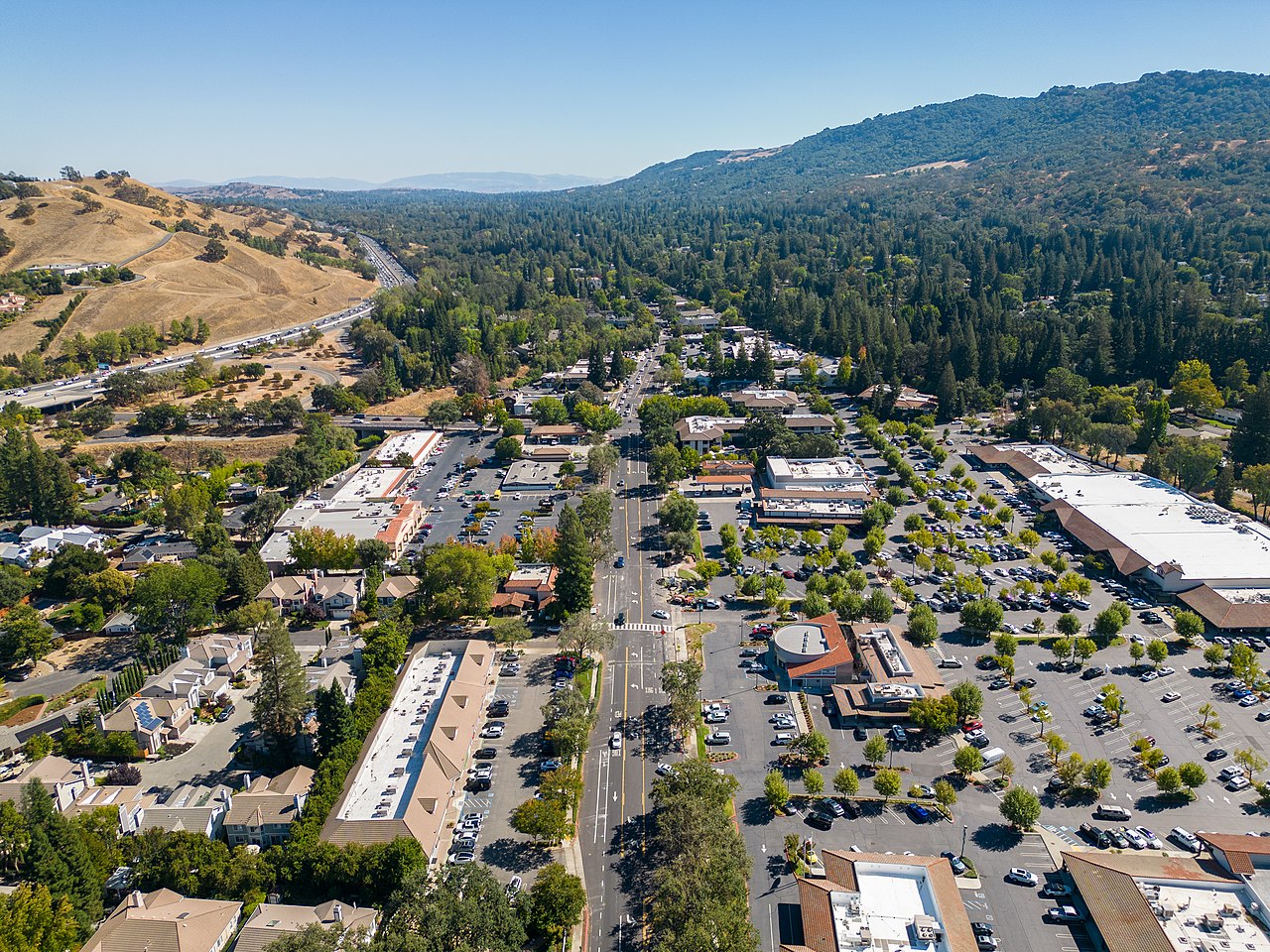
Tucked between Walnut Creek and Danville, Alamo offers a peaceful, semi-rural retreat with an upscale East Bay charm. While Alamo is an unincorporated community managed by Contra Costa County, it maintains a close-knit and distinct character. Most of the town's 15,000 residents enjoy custom single-family homes on spacious, tree-canopied lots. Daily errands center around the intersection of Danville Boulevard and Stone Valley Road, where a walkable cluster of grocery stores, cafes, and small businesses serves as the community's informal town center.
Alamo's ranching roots remain evident in its quiet country lanes, equestrian properties, and heritage valley oaks. The area's history blends naturally into daily life, especially along the former Southern Pacific rail line that has been transformed into the paved Iron Horse Regional Trail. Along this corridor, Hemme Station Park provides play structures and historic displays where the old train depot once stood, giving joggers and families a pleasant resting spot on their neighborhood walks.

Getting around the Bay Area is straightforward from Alamo. Interstate 680 runs right through the valley for drivers heading north toward Concord or south toward the Tri-Valley, while Danville Boulevard offers a scenic local alternate. Commuters can reach nearby Walnut Creek BART stations via a short drive or local bus connection for quick trips into Oakland and San Francisco. For errands closer to home, the Iron Horse Trail allows residents to walk or bike straight into Alamo Plaza without getting in the car.

Access to parks and open space makes outdoor living a central part of the Alamo lifestyle. Livorna Park serves as a neighborhood favorite for summer concerts, playgrounds, and sports courts, while Hap Magee Ranch Park offers historic barn structures, wide lawns, and popular dog runs. Rising directly to the west, the expansive hills of Las Trampas Regional Wilderness give hikers and mountain bikers miles of quiet trails with panoramic views across the San Ramon Valley.
Top Rating Signals
Highest current ratings for this town.
Loading town details...