
Cedar Bluff, VA
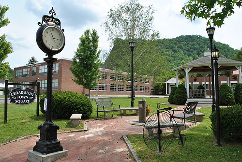
- Elevation
- 1,955 ft
- General Quality Overall rating out of 100
Highlights
What stands out in Cedar Bluff
Explore
More places like Cedar Bluff
About Cedar Bluff
Cedar Bluff sits right along the Clinch River in southwest Virginia, starting out as a nineteenth-century mill town shaped by the river's waterfalls and the historic Old Kentucky Turnpike. You can still see that heritage today as you drive through town, from the classic roller mill and hillside houses to the old school building overlooking the valley. It has the distinct feel of a traditional Appalachian community with deep local roots.

Daily life here is relaxed and scenic, with the river remaining a central backdrop. Cedar Bluff Overlook Park gives residents a great spot to take in mountain views, and the Clinch itself is popular for weekend fishing and paddling. For major shopping, specialized healthcare, and larger job markets, Bluefield and nearby hubs are an easy drive away, while local schools, small businesses, and quiet neighborhoods keep everyday living simple and grounded.
Top Rating Signals
Highest current ratings for this town.
Loading town details...