
Oxnard, CA

- Elevation
- 52 ft
- General Quality Overall rating out of 100
Highlights
What stands out in Oxnard
Explore
More places like Oxnard
About Oxnard
Oxnard offers a distinct coastal setting where open farmland, protected wetlands, and uncrowded Pacific beaches sit right beside working commercial hubs. Down at the southern edge of town, the dunes of Ormond Beach provide a peaceful spot for walking and birdwatching, with local restoration projects underway to protect the native shoreline. Just beyond the residential neighborhoods, the fertile Oxnard Plain still yields year-round crops like strawberries and celery. Over by the water, the scene shifts toward maritime living. The Port of Hueneme handles busy commercial shipping, while Channel Islands Harbor offers a relaxed waterfront community with residential canals, boat slips, kayak rentals, and casual seafood spots. The city originally grew around agriculture and the railway in the late 1800s, quickly expanding after a major sugar beet factory opened.
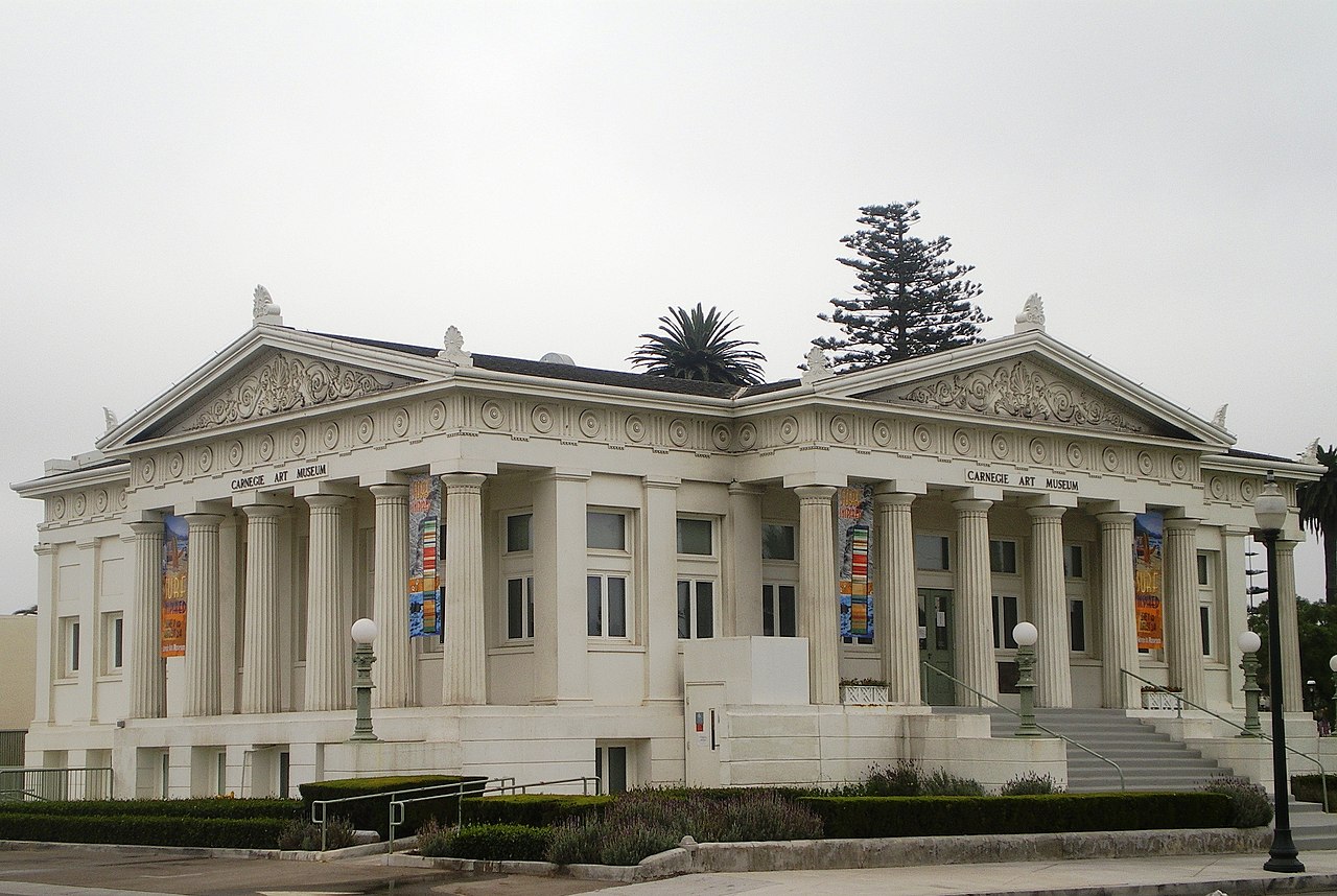
Generations of Mexican, Japanese, and Chinese families helped build the agricultural foundation, creating a strong cultural heritage that defines the city today. Major employers also support the local economy, particularly Naval Base Ventura County at Point Mugu and Port Hueneme, which maintains a large defense and engineering presence along the coast. When exploring neighborhoods, you will notice three main areas. There is the historic downtown center, newer residential developments and outdoor shopping centers along Highway 101 such as The Collection at RiverPark, and classic beachside enclaves like Silver Strand and Hollywood Beach.

Commuting is relatively easy compared to much of Southern California. The downtown transportation center connects residents directly to Los Angeles, Burbank, and Santa Barbara through Metrolink and Amtrak rail lines, as well as regional bus routes. Daily routines tend to reflect your choice of neighborhood. Some locals spend their weekends paddleboarding through harbor channels or biking along the coast, while others head to the northern corridor for dining, shopping, and entertainment. Across town, local parks and community centers offer recreation programs and neighborhood sports leagues for families.

The downtown district retains a lot of historic character, centered around Plaza Park and the historic 1907 Carnegie Library building. Nearby Heritage Square preserves beautiful Victorian and Craftsman architecture, hosting outdoor summer concerts, wine tastings, and seasonal events. Community gatherings happen throughout the year, from cultural celebrations to the annual California Strawberry Festival that honors the region's farming roots. For newcomers, Oxnard delivers fresh ocean breezes, incredible authentic dining, convenient transit links, and an approachable, down-to-earth coastal atmosphere.
Top Rating Signals
Highest current ratings for this town.
Loading town details...