
Zionsville, IN
- Elevation
- 844 ft
- General Quality Overall rating out of 100
Highlights
What stands out in Zionsville
Explore
More places like Zionsville
About Zionsville
Zionsville was built around the railroad, and today that old train line is one of the best perks of living here. Back in the 1850s, the tracks brought passenger trains, commerce, and even Abraham Lincoln, who traveled through town on his inaugural tour and later on his funeral train. After train service ended in the late twentieth century, the town turned the corridor into the paved Big-4 Rail Trail. Instead of steam engines, you now see neighbors out for morning runs, families pushing strollers, and cyclists cruising straight into the center of town.

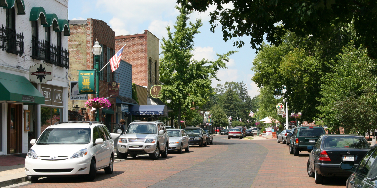
At the heart of the community is the historic Village, famous for its brick-paved Main Street, local shops, and leafy residential streets. Outside the downtown core, Zionsville spreads across southeastern Boone County with plenty of different neighborhood styles. You can choose from walkable historic properties, modern subdivisions with neighborhood pools, or quiet homes on larger wooded lots toward Interstate 65 and Michigan Road. Having quick access to these main roads makes it easy to enjoy a quiet suburban feel while keeping your commute into Indianapolis manageable.

Daily errands and commutes are easy to balance without losing the small-town feel. Everyday shopping centers, grocery stores, and casual dining spots line Michigan Road on the east side of town, keeping heavy traffic away from the historic district. Local employers have space at Creekside Corporate Park, which was built with green ravines and walking paths right next to Interstate 465. Being on the northwest corner of the Indianapolis metro also puts you within an easy drive of major hospitals, tech campuses, and corporate headquarters across Carmel and Marion County.

Local events give the town a friendly, close-knit atmosphere throughout the year. On summer Saturday mornings, residents head to the south end of Main Street for the popular Zionsville Farmers Market. The SullivanMunce Cultural Center hosts local art exhibits, museum collections, and creative classes, while the Zionsville Nature Center inside the Hussey-Mayfield library gives kids a hands-on look at local wildlife. Because the Big-4 Rail Trail runs right past Town Hall, local parks, and Village storefronts, you can bike or walk to almost all of these weekend spots without ever needing to find parking.
Top Rating Signals
Highest current ratings for this town.
Loading town details...