
Altadena, CA
- Elevation
- 1,355 ft
- General Quality Overall rating out of 100
Highlights
What stands out in Altadena
Explore
More places like Altadena
About Altadena
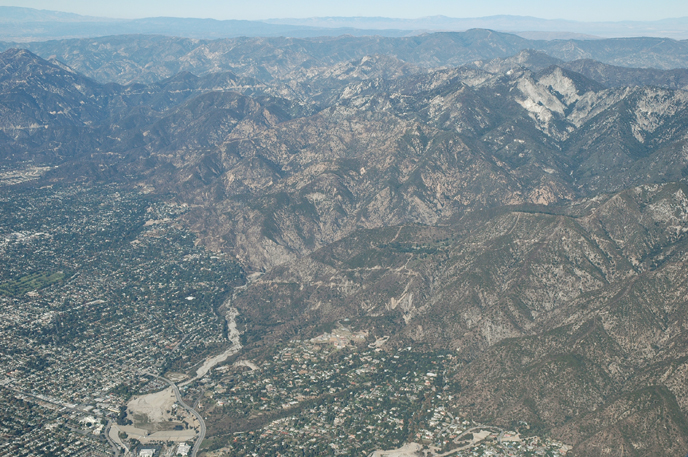
Nestled right against the base of the San Gabriel Mountains directly above Pasadena, Altadena has long attracted people looking for a relaxed foothill setting with plenty of character. Because it remains an unincorporated community, Los Angeles County manages municipal services like zoning, roads, and parks rather than a traditional city hall. The area has no single downtown core, so daily life centers around quiet, winding residential streets, generous lot sizes, and distinctive architecture that includes classic Craftsman bungalows and mid-century modern ranches. It feels tucked away and close to nature, yet still sits just a short drive from Pasadena's dining and retail hubs.

The community has a rich, diverse history shaped by decades of grassroots community building. In the mid-twentieth century, neighborhoods like The Meadows became celebrated hubs for Black middle-class families, and local residents actively organized for fair housing and open integration across the area. That pride runs deep through the local churches, civic groups, and neighborhood spots that give Altadena its tight-knit feel. That resilience became vital after the Eaton Fire swept through the foothills in early 2025, damaging thousands of homes, local businesses, and community buildings across the area.

Rebuilding efforts continue across the foothills, with county programs helping residents navigate permits, property assessments, and infrastructure repairs. If you are exploring a move here, you will see a community actively putting itself back together. Dedicated county permit centers and community hubs provide step-by-step guidance for homeowners and prospective buyers alike. While several beloved outdoor spots and recreation areas, including parts of Eaton Canyon, Farnsworth Park, and the Altadena Golf Course, have seen temporary closures during repair work, restoration teams are steadily working to reopen them.

Everyday amenities are continuing to adapt and serve residents during this transition. The Bob Lucas Memorial Library on Lincoln Avenue recently completed a major expansion, offering new literacy programs, tutoring spaces, and a welcoming outdoor garden. Meanwhile, the Main Library on Mariposa Street is undergoing its own planned renovation, with temporary services running out of the Loma Alta Park social hall so patrons can easily borrow books and access community events. Altadena remains a warm, grounded foothill town where neighbors look out for one another and the mountain views stay front and center.
Top Rating Signals
Highest current ratings for this town.
Loading town details...