
East Palo Alto, CA

- Elevation
- 16 ft
- General Quality Overall rating out of 100
Highlights
What stands out in East Palo Alto
Explore
More places like East Palo Alto
About East Palo Alto
East Palo Alto has a history unlike anywhere else in Silicon Valley. For most of the twentieth century, the area was unincorporated county land filled with flower farms and family homes, while neighboring towns chipped away at its borders through annexations. During an era of redlining and post-war growth, it became a resilient, tight-knit hub for the Peninsula's Black community. Residents spent decades organizing for self-government, finally voting to incorporate as an independent city in 1983 by a razor-thin margin of 15 votes. Today, East Palo Alto packs a deep sense of heritage and local pride into a compact two and a half square miles.
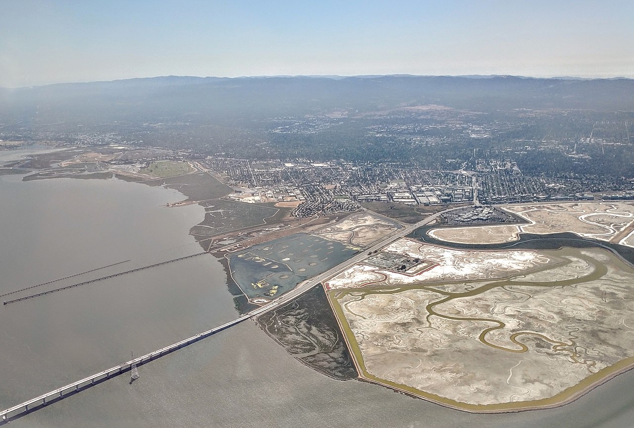
Bordered by Palo Alto, Menlo Park, and the San Francisco Bay, the city sits in a prime commute location. Highway 101 cuts directly through town, creating two distinct sides, while University Avenue serves as the main artery connecting the Dumbarton Bridge to downtown Palo Alto. Neighborhoods like The Gardens, University Village, and Palo Alto Park offer quiet residential streets within minutes of major tech campuses. Getting around is straightforward, whether you are driving to Silicon Valley job hubs, catching a bus to Stanford, or using local on-demand transit shuttles.

The housing landscape features a mix of mid-century single-family houses, apartment complexes, and newer residential developments. With a long tradition of rent stabilization and strong tenant protections, local leaders have focused on keeping longtime residents rooted despite regional cost-of-living pressures. Around Bay Road and the Ravenswood district, active redevelopment is bringing modern housing, neighborhood retail, and updated streetscapes to former industrial properties. It is an evolving corridor where established family-run businesses and fresh investment share the same blocks.

Community gatherings often revolve around neighborhood parks and the branch library on University Avenue, which hosts family activities, workshops, and seasonal events throughout the year. For outdoor recreation, the standout spot is Cooley Landing. Once a county landfill on the shoreline, the site was cleaned up and transformed into a scenic nine-acre waterfront park. Today, visitors can walk along the Bay Trail, check out the modern education center, and take in wide-open views across the wetlands and the bay.
Top Rating Signals
Highest current ratings for this town.
Loading town details...