
Palo Alto, CA

- Elevation
- 29 ft
- General Quality Overall rating out of 100
Highlights
What stands out in Palo Alto
Explore
More places like Palo Alto
About Palo Alto
Palo Alto grew up right alongside Stanford University, and the two have been intertwined ever since the 1890s. While Stanford has its own campus address, its energy spills into every corner of town. Over the decades, academic research helped transform what was once quiet farmland into the intellectual heart of Silicon Valley. Tech giants and startups still fill the Stanford Research Park along Page Mill Road, and the university medical center sits just across the border. Geographically, the city stretches from the salt marshes of the Baylands nature preserve, through leafy residential neighborhoods, up into open rolling foothills past Interstate 280.
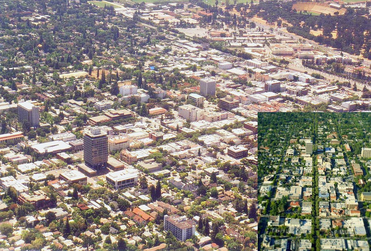
Daily life is concentrated on the flat valley floor between San Francisquito Creek and the neighboring towns. Instead of a single central hub, Palo Alto has two distinct downtowns, each anchored by its own Caltrain station. University Avenue is the livelier, polished main drag filled with upscale restaurants, boutiques, and coffee shops buzzing with venture capitalists and students. A mile south, California Avenue offers a slightly more relaxed vibe, with weekend farmers markets and pedestrian-friendly dining. In between, quiet tree-lined streets connect neighborhood shopping spots like Midtown with top-rated public schools and neighborhood parks. Palo Alto also runs its own city-owned electric, gas, water, and fiber-optic utilities, which keeps service remarkably reliable.

That focus on local quality of life shows up in how residents spend their weekends. The city turned the central stretch of California Avenue into a permanent pedestrian zone, opening up the street for outdoor patio dining, live music, and evening strolls. It gives the area a European plaza feel that contrasts with the bustling energy along University Avenue. Families also benefit from deep community investments that date back generations. The Lucie Stern Community Center remains a beloved hub, bringing together a community theater, arts programs, and grassy picnic grounds in one historic Spanish-style complex.

Right next to the community center, you will find the country's first dedicated children's library alongside the Palo Alto Junior Museum and Zoo, where local kids grow up meeting rescued animals and exploring hands-on science exhibits. Tucked into a residential street nearby is the famous garage where Hewlett and Packard launched their company, a quiet reminder of how a global tech revolution started in a standard backyard shed. That mix of world-class innovation and close-knit neighborhood charm is what draws people here. Between the easy train commute, beautiful foothill trails, and quiet streets, Palo Alto offers a complete package for newcomers looking to settle in the Peninsula.
Top Rating Signals
Highest current ratings for this town.
Loading town details...