
Lancaster, CA
- Elevation
- 2,352 ft
- General Quality Overall rating out of 100
Highlights
What stands out in Lancaster
Explore
More places like Lancaster
About Lancaster
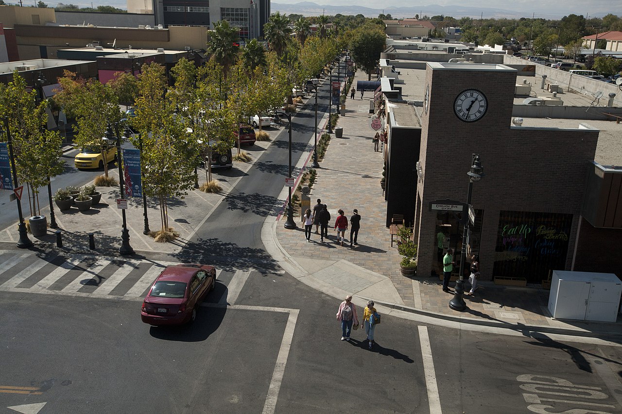
Downtown Lancaster, known locally as The BLVD, serves as the city's main social and cultural hub. This walkable stretch features casual restaurants, sidewalk cafes, local boutiques, the Museum of Art and History, and the Lancaster Performing Arts Center. Sidewalk monuments pay tribute to the legendary test pilots who flew at nearby Edwards Air Force Base, adding a unique touch to an evening stroll. From spring through the fall, the area fills up on Thursday evenings for a popular farmers market, where residents gather for fresh produce, food trucks, and live music on the outdoor stage.

Aviation and advanced manufacturing remain key economic drivers throughout the Antelope Valley, but Lancaster has also built a growing reputation in green technology. Manufacturing facilities here build electric transit buses, supplying modern fleets used across Southern California. For those working locally or commuting, the transportation network is straightforward. Local buses connect neighborhoods to Antelope Valley College and the regional medical center, while the downtown Metrolink station gives rail commuters a convenient alternative to driving south toward Los Angeles.

Set across a broad high-desert plain, Lancaster is framed by the San Gabriel Mountains to the south and the Tehachapi range to the northwest. The city layout consists of wide, easy-to-navigate avenues lined with spacious single-family homes, shopping plazas, and neighborhood parks. Moving here often appeals to buyers looking for larger lots and more square footage at prices well below the Los Angeles county average. Open desert landscapes dotted with native Joshua trees sit just outside the neighborhoods, offering clear desert air and scenic mountain views.

Families and students benefit from strong community resources right in town. Antelope Valley College is a central educational hub, offering degree programs alongside specialized technical coursework tailored to the valley's aerospace employers. For outdoor recreation, the Prime Desert Woodland Preserve gives residents more than three miles of tranquil walking trails winding through undisturbed desert flora and fauna. With its blend of steady career paths, family-friendly neighborhoods, and accessible outdoor spaces, Lancaster provides a practical, comfortable lifestyle in the high desert.
Top Rating Signals
Highest current ratings for this town.
Loading town details...