
Menlo Park, CA

- Elevation
- 70 ft
- General Quality Overall rating out of 100
Highlights
What stands out in Menlo Park
Explore
More places like Menlo Park
About Menlo Park
Highway 101 runs straight through Menlo Park, creating two distinct sides of town with their own unique character. West of the freeway, you will find the tree-lined historic neighborhoods, the bustling downtown strip along Santa Cruz Avenue, and the Caltrain station. East of 101 lies Belle Haven and the Bayfront area, a neighborhood with deep community roots that has seen rapid changes alongside the growth of major tech campuses. Because the highway physically separates these areas into different school districts and daily routines, deciding which side of the freeway fits your lifestyle is often the first step when planning a move here.

For a relatively quiet suburb, Menlo Park has an outsized presence in the global economy. Venture capital firms line Sand Hill Road up toward Stanford, while Meta's sprawling campus anchors the bayfront. In between, you will find research hubs like SRI International alongside specialized biotech and software offices. Downtown caters to everyday living, centered on Santa Cruz Avenue with independent coffee shops, neighborhood bookstores, and lively sidewalk dining. Each district has its own distinct rhythm, giving residents easy access to major employers alongside quiet residential streets.
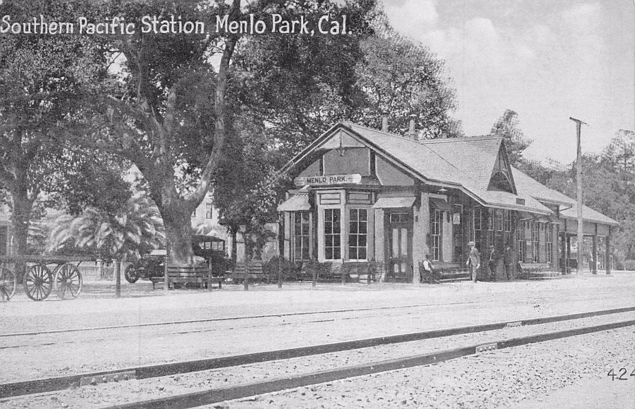
The town's history stretches back to the 1850s, when two Irish immigrants built an arched wooden gate reading "Menlo Park" at the entrance to their homestead. The name stuck, and when the railroad arrived a decade later, the local stop adopted it. That original Victorian depot still stands downtown as California's oldest continuously operating passenger train station. During World War I, the area briefly became Camp Fremont, a massive military base that gave the community its first paved roads, water systems, and local hospital. Today, Fremont Park preserves that era's name, hosting summer concerts and family gatherings right by the downtown shops.
Recreation options spread across the city, from traditional downtown parks to the bay shoreline. On the east side, the modern Belle Haven Community Campus offers a public library, pool, youth programs, and senior services. Further toward the water, Bedwell Bayfront Park provides miles of trails with panoramic views across the bay and the neighboring wildlife refuge. Whether you are picking up fresh produce at the Sunday downtown farmers market or cycling across the pedestrian bridges along the Bay Trail, the city makes it easy to get outside and enjoy the Peninsula sunshine.
Top Rating Signals
Highest current ratings for this town.
Loading town details...